


Turnerville Community, Mobile County, Alabama
About
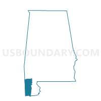
Outline

Summary
| Unique Area Identifier | 522561 |
| Name | Turnerville Community |
| County | Mobile County |
| State | Alabama |
| Area (square miles) | 76.35 |
| Land Area (square miles) | 76.15 |
| Water Area (square miles) | 0.20 |
| % of Land Area | 99.74 |
| % of Water Area | 0.26 |
| Latitude of the Internal Point | 30.97174880 |
| Longtitude of the Internal Point | -88.11989140 |
Maps


Graphs
Select a template below for downloading or customizing gragh for Turnerville Community, Mobile County, Alabama


Neighbors
Neighoring Voting District (by Name) Neighboring Voting District on the Map
- Chunchula Baptist Church, Mobile County, AL
- First Baptist Church of Axis, Mobile County, AL
- Howard Blackwell Lodge, Mobile County, AL
- Kali Oka Civic Club, Mobile County, AL
- Mt. Vernon Civic Center, Mobile County, AL
- Old Citronelle Senior Center, Mobile County, AL
Top 10 Neighboring County Subdivision (by Population) Neighboring County Subdivision on the Map
- Mobile CCD, Mobile County, AL (236,809)
- Citronelle CCD, Mobile County, AL (9,534)
- Mount Vernon CCD, Mobile County, AL (4,942)
Top 10 Neighboring Place (by Population) Neighboring Place on the Map
Top 10 Neighboring Unified School District (by Population) Neighboring Unified School District on the Map
Top 10 Neighboring State Legislative District Lower Chamber (by Population) Neighboring State Legislative District Lower Chamber on the Map
- State House District 102, AL (50,860)
- State House District 96, AL (50,198)
- State House District 98, AL (37,831)
Top 10 Neighboring State Legislative District Upper Chamber (by Population) Neighboring State Legislative District Upper Chamber on the Map
Top 10 Neighboring 111th Congressional District (by Population) Neighboring 111th Congressional District on the Map
Top 10 Neighboring Census Tract (by Population) Neighboring Census Tract on the Map
- Census Tract 57, Mobile County, AL (7,182)
- Census Tract 56, Mobile County, AL (7,164)
- Census Tract 61.05, Mobile County, AL (6,575)
- Census Tract 60, Mobile County, AL (4,996)
- Census Tract 58, Mobile County, AL (4,942)
- Census Tract 61.04, Mobile County, AL (4,592)
- Census Tract 59, Mobile County, AL (4,538)
- Census Tract 55, Mobile County, AL (2,973)
Top 10 Neighboring 5-Digit ZIP Code Tabulation Area (by Population) Neighboring 5-Digit ZIP Code Tabulation Area on the Map
- 36571, AL (14,423)
- 36522, AL (7,183)
- 36572, AL (6,340)
- 36521, AL (5,431)
- 36560, AL (3,690)
- 36525, AL (1,935)
- 36505, AL (1,481)
- 36512, AL (46)